Property Record
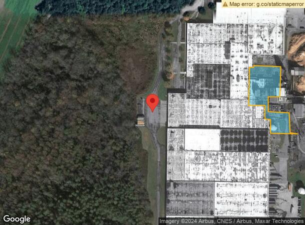
400 Kellys Creek Rd, Rabun Gap, GA 30568
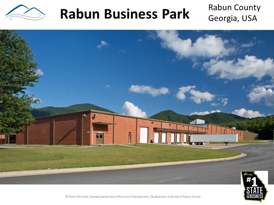
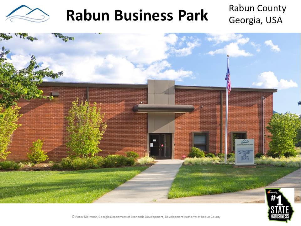
This Property Is For Sale
Current Lease Availabilities
NEARBY LISTINGS FOR SALE OR LEASE
Property Detail
400 Kellys Creek Rd
Governmentalpublicusegeneral
LL 134 135 136 146 LD 2
A
Rabun
13241C0109D
Georgia
0
4.64 AC
2024
Georgia Northeast
970102
Other Market Areas
977,485 SF
048-028
DEMOGRAPHICS near 400 Kellys Creek Rd
1 Mile
3 Mile
5 Mile
2024 Total Population
322
2,623
6,036
2029 Population
337
2,713
6,275
Pop Growth 2024-2029
+ 4.66%
+ 3.43%
+ 3.96%
Average Age
47
45
47
2024 Total Households
144
1,113
2,631
HH Growth 2024-2029
+ 4.86%
+ 3.14%
+ 3.80%
Median Household Inc
$33,965
$51,624
$51,916
Avg Household Size
2.20
2.30
2.30
2024 Avg HH Vehicles
2.00
2.00
2.00
Median Home Value
$210,714
$222,187
$230,992
Median Year Built
1985
1983
1984
Nearby Places
- Restaurants
- Banks
- Shops
- Fitness
- Groceries
Nearby Properties
Address
Land Use
TOTAL SIZE
Lot Size
Zoning
Address
Land Use
TOTAL SIZE
Lot Size
Zoning
977,485 SF
85.55 AC
M1
Address
Land Use
TOTAL SIZE
Lot Size
Zoning
769,487 SF
170.62 AC
M2
Address
Land Use
TOTAL SIZE
Lot Size
Zoning
8,820 SF
60.34 AC
CB
Address
Land Use
TOTAL SIZE
Lot Size
Zoning
31,098 SF
2.16 AC
HB
Address
Land Use
TOTAL SIZE
Lot Size
Zoning
314.37 AC
A
Address
Land Use
TOTAL SIZE
Lot Size
Zoning
47,704 SF
3.38 AC
CB
Address
Land Use
TOTAL SIZE
Lot Size
Zoning
34,424 SF
11.98 AC
A
Address
Land Use
TOTAL SIZE
Lot Size
Zoning
18,800 SF
1.07 AC
CB
Address
Land Use
TOTAL SIZE
Lot Size
Zoning
12,300 SF
2.42 AC
CB
Address
Land Use
TOTAL SIZE
Lot Size
Zoning
15,428 SF
2.66 AC
CB
Address
Land Use
TOTAL SIZE
Lot Size
Zoning
4,304 SF
1.66 AC
HB
Address
Land Use
TOTAL SIZE
Lot Size
Zoning
4,908 SF
6.30 AC
HB
Address
Land Use
TOTAL SIZE
Lot Size
Zoning
30,631 SF
4.11 AC
Address
Land Use
TOTAL SIZE
Lot Size
Zoning
8,289 SF
0.74 AC
CB
Address
Land Use
TOTAL SIZE
Lot Size
Zoning
28,000 SF
6.71 AC
M2
Address
Land Use
TOTAL SIZE
Lot Size
Zoning
69.11 AC
M1
Address
Land Use
TOTAL SIZE
Lot Size
Zoning
89.64 AC
A
Address
Land Use
TOTAL SIZE
Lot Size
Zoning
7,552 SF
3.46 AC
CB
Address
Land Use
TOTAL SIZE
Lot Size
Zoning
20,605 SF
3.52 AC
CB
Address
Land Use
TOTAL SIZE
Lot Size
Zoning
3,600 SF
0.65 AC
CB
Address
Land Use
TOTAL SIZE
Lot Size
Zoning
27,848 SF
7.25 AC
R1
Address
Land Use
TOTAL SIZE
Lot Size
Zoning
3,500 SF
4.02 AC
CB
Address
Land Use
TOTAL SIZE
Lot Size
Zoning
10,238 SF
1.61 AC
CB
Address
Land Use
TOTAL SIZE
Lot Size
Zoning
3,994 SF
1.63 AC
CB
Address
Land Use
TOTAL SIZE
Lot Size
Zoning
13,776 SF
1.45 AC
CB
Address
Land Use
TOTAL SIZE
Lot Size
Zoning
4,318 SF
0.47 AC
CB
Address
Land Use
TOTAL SIZE
Lot Size
Zoning
9.21 AC
R
Address
Land Use
TOTAL SIZE
Lot Size
Zoning
10,302 SF
4.94 AC
Address
Land Use
TOTAL SIZE
Lot Size
Zoning
63.32 AC
A
The World's #1 Commercial Real Estate Marketplace
Connect with us
© 2025 CoStar Group
The information above has been obtained from sources believed reliable. While we do not doubt its accuracy we have not verified it and make no guarantee, warranty or representation about it. It is your responsibility to independently confirm its accuracy and completeness. Any projections, opinions, assumptions, or estimates used are for example only and do not represent the current or future performance of the property. The value of this transaction to you depends on tax and other factors which should be evaluated by your tax, financial, and legal advisors. You and your advisors should conduct a careful, independent investigation of the property to determine to your satisfaction the suitability of the property for your needs.